• Wasiliana nasi |
    • Maswali ya Mara kwa Mara |
    • Barua pepe za Wafanyakazi |
    • Malalamiko |
Kondoa Town Council
Kondoa Town Council

Jamhuri ya Muungano wa Tanzania Ofisi ya Rais Tawala za Mikoa na Serikali za Mitaa Halmashauri ya Mji wa Kondoa

  • Mwanzo
  • Kuhusu Sisi
    • Historia
    • Dhima na Dira
    • Maadili ya Msingi
    • Mikakati
  • Utawala
    • Muundo wa Taasisi
    • Idara
      • Idara ya Afya
      • Idara ya Maji
      • Idara ya Utumishi na Utawala
      • Idara ya Mipango ,Takwimu na Ufuatiliaji
      • Idara ya Fedha na Biashara
      • Idara ya Elimu Msingi
      • Idara ya Elimu sekondari
      • Idara ya Kilimo,Umwagiliaji na Ushirika
      • Idara ya Mifugo na Uvuvi
      • Idara ya Ardhi na Maliasili
      • Idara ya Maendeleo ya Jamii na Ustawi wa Jamii
      • Idara ya Ujenzi na Zimamoto
      • Idara ya Usafi na Mazingira
    • Kitengo
      • Kitengo cha Sheria
      • Kitengo cha Teknolojia,Habari,Mawasiliano na uhusiano
      • Kitengo cha Manunuzi
      • Kitengo cha Uchaguzi
      • Kitengo cha Nyuki
      • Kitengo cha Ukaguzi wa Ndani
  • Fursa za Uwekezaji
    • Vivutio vya Utalii
    • Kilimo
    • Ufugaji
  • Huduma Zetu
    • Elimu
    • Ustawi wa Jamii
    • Afya
    • Huduma za Maji
    • Huduma za Kilimo
    • Huduma za Ufugaji
    • Huduma za Watumishi
  • Madiwani
    • Orodha ya Waheshimiwa Madiwani
    • Kamati za Kudumu za Halmashauri
      • Fedha na Uongozi
      • Mipango Miji na Mazingira
      • Uchumi,Afya na Elimu
      • UKIMWI
    • Ratiba
      • Ratiba ya Vikao vya Waheshimiwa Madiwani
      • Ratiba ya Kuonana na Mwenyekiti
  • Miradi
    • Miradi Inayoendelea
    • Miradi Iliyokamilika
    • Miradi Itakayotekelezwa
  • Machapisho
    • Sheria Ndogo
    • Mkataba wa Huduma kwa Wateja
    • Mpango mkakati
    • Ripoti Mbalimbali
    • Fomu Mbalimbali
    • Miongozo Mbalimbali
    • Majarida
  • Kituo cha habari
    • Taarifa Kwa Umma
    • Video za Shughuri za Ofisi au Kitaifa
    • Hotuba za Viongozi Mbalimbali
    • Maktaba ya Picha

Wasifu wa Kijamii na Kiuchumi Halmashauri ya Mji

Introduction


Kondoa Town Socio-economic profile is the tool that provides the bird-eyes-views of the group of community in the Town area in order to ensure sustainable development in the community. It assist wards in identifying unique and shared characteristics for the purpose of implementing growth strategies, development planning, and supporting and growing local services. It displays combined and comparable statistical snapshots of the communities in the town.

The purpose of this Kondoa Town socio-economic profile is to describe the land, climate, agro-ecological zones and people; the district economy; productive sectors; economic infrastructure; social services and other development issues. The intention of this profile is to provide a solid foundation for two legs of the triple-bottom line by digging deeply into both the economic and social dimensions of the Kondoa Town. The work is divided into six chapters including the first chapter with land, climate, agro-ecological zones and people; the second chapter with the district economy; the third chapter with productive sectors; the forth chapter with economic infrastructures; the fifth chapter with social services and the last chapter with other development issues.

The first chapter examines the location and physical features, area and administrative units, population distribution, ethnic groups, climate, vegetation and agro-ecological zones. Then, the second chapter have considered the town economy in which the description for the basic land use have been narrated, crop production, livestock, beekeeping, forest, game, GDP and per capita income, accessibility to basic services, social economic conditions, social-economic development indicators and employment. On the other hand, the third chapter has described the productive sectors which includes agriculture (includes crop production, horticulture, farm implements), livestock, natural resources (includes forest,  aforestation and soil conservation, agro-forestry, beekeeping, game and small scale industrial development. The forth chapter describes various issues related to economic infrastructures including road network, air services, communication facilities and energy (including electricity and charcoal firewood). Social Services have been described in the fifth chapter containing education, health sector and water sector. Finally, the last chapter contains other development issues which describe the area based programs relevant to LGRP and investment opportunities.

TABLE OF CONTENTS

Contents

Introduction. 1

TABLE OF CONTENTS. 2

LIST OF TABLES. 5

LIST OF PLATES. 6

ABBREVIATIONS. 7

CHAPTER ONE.. 8

1.0 Land, Population, Climate  And Agro- Ecological Zones. 8

1.1 Location and physical features. 8

1.2 Area and Administrative units. 8

1.3 Population distribution. 9

1.4 Ethnic Groups. 9

1.5 Climate. 9

1.6 Vegetation. 9

1.7 Agro-Ecological zones. 10

CHAPTER TWO.. 11

2.0 The Town Economy. 11

2.1 The basic land use. 11

2.2 Crop production. 11

2.3 Livestock. 12

2.4 Bee keeping. 13

2.5 Forest 13

2.6 Game. 13

2.7 GDP and per capital 13

2.8 Accessibility to Basic Services. 13

2.9 Social Economic Conditions. 13

2.10 Social – Economic Development Indicators. 14

Key ratio’s. 14

2.11 Employment 15

CHAPTER THREE.. 16

3.0 Productive Sector 16

3.1 Agriculture. 16

3.2 Crop production. 16

3.3 Horticulture. 16

3.4 Farm implements. 16

3.7 Livestock. 17

3.8.0 Natural Resources. 17

3.8.1 Forest 17

3.8.2 Afforestation and soil conservation. 17

3.8.3 Agro-forestry. 18

3.8.4 Bee keeping. 18

3.8.5 Game. 18

3.8.6 Small Scale Industrial Development 18

CHAPTER FOUR.. 19

4.0 Economic Infrastructure. 19

4.1Road network. 19

4.2 Air services. 19

4.3 Communication facilities. 20

4.4.0 Energy. 20

4.4.1 Electricity. 20

4.4.2 Charcoal/fire wood. 20

CHAPTER FIVE.. 21

5.0 Social Services. 21

5.1Education. 21

5.1.1 Primary Education. 21

5.1.1.1 Education Facilities. 21

5.1.1.2 Education Staff. 22

5.1.2 Secondary schools. 22

5.1.2.1 Training institutions. 22

5.2 Health Sector 22

4.2.1 Health situation. 22

5.3 Water Sector 24

5.3.1 Water and sanitation sector 24

5.3.2 Rural water supply. 25

5.3.3 Urban water supply. 25

CHAPTER SIX.. 26

6.0 Other Development Issues. 26

6.1 Inventory of Area Based Programmes Relevant to Ll G RP. 26

6.2 Investment Opportunities. 28

6.2.1 Irrigation schemes. 28

6.2.2 Bee Farming. 29

6.2.3 Tourism.. 30

6.2.3.1 Natural Water Spring - Kondoa Town. 30

6.2.3.2 Historical sites in Kondoa town. 30

6.2.3.3 Investment on touristic recreation centres. 32

6.2.4 Beef farming-Fattening. 33

6.2.5 Kondoa Veterinary Centre. 33

6.2.6 Construction of Bus stand. 34

6.2.7Construction of Heavy truck stops. 34

6.2.8 Economic Processing zone/Area. 34

6.2.9 One stops Business and marketing information centre. 34


LIST OF TABLES


Table 1: Administrative Units of Kondoa Township. 1

Table 2: Administrative Units of Kondoa Town. 1

Table 3: Population Distribution by wards and sex. 2

Table 4: Main Agro-Ecological Zones. 3

Table 5: Crop production  compared to area cultivated in 2015/2016. 4

Table 6: Number of Livestock per ward. 5

Table 7: Livestock services and infrastructure. 5

Table 8: Selected social and economic indicators for 7

Table 9: Farm implements by 2015/2016. 10

Table 10: Animal population, 2015/2016. 11

Table 11: Livestock support infrastructure. 11

Table 12: Tree Plantation by ownership seedlings by 2015. 12

Table 13: Road network -Length (in km) and type. 13

Table 14: Primary school enrolment by 2016. 15

Table 15: Primary school enrolment by sex. 15

Table 16: STD 1 enrolment by sex. 15

Table 17: Permanent classroom 2016. 15

Table 18 : Desks. 15

Table 19: The number and grades of teachers (2016) 16

Table 20:Secondary school enrolment by sex and level 16

Table 21: Top Ten Common Diseases. 17

Table 22: Present health facilities. 17

Table 23:Present health services ratios (2012) 17

Table 24: Community Based Health service (2012) 18

Table 25: Community Based Health service 2016. 18

Table 26: Status of water supply   up to 2016. 18


LIST OF PLATES

Plate 1: Rice Cultivated at Mongoroma Village. 23

Plate 2: Beehives in 2 different ways of bee farming. 24

Plate 3: Colonial Hanging Bridge at Kondoa Town. 25

Plate 4: Kolo Rock Paints. 26

Plate 5: Construction of Bus stand. 28


ABBREVIATIONS

a. s. l.               -           Above sea level

AIDS              -          Acquired Immune Deficiency Syndromes

AWF               -           Africa Wild Life

Cum                -           Metre cube

DSM               -           Dar es Salaam

etc                   -         extra time call

GDP               -          Gross Domestic Product

ha                    -           Hectare

HADO                        -           Hifadhi Ardhi Dodoma

HH                  -           House Hold

HHS               -           House Hold Size

Kg                   -          Kilogram

KKKT             -          Kanisa la Kiinjili la Kilutheri Tanzania

Km                  -           Kilometre

Km2                 -          Square Kilometre

KTEO (PS)      -         Kondoa Town Education Office for Primary Schools 

KTEO (SS)      -         Kondoa Town Education Office for Secondary Schools

KTH                -           Kondoa Town Hospital

KTHRO          -          Kondoa Town Human Resource Office

KTIO              -          Kondoa Town Irrigation Officer

KTLO             -          Kondoa Town Land Office

KTNRO          -           Kondoa Town Natural Resources Officer

KTPLO           -           Kondoa Town Planning Officer

KTWE            -           Kondoa Town Water Engineer

LU                   -             Livestock Unit

LW  -            Livestock Weight

M                     -           Metre

m2                    -           Square Metre

mm                 -            Millimetres

Mm                  -             Millimetre

Sq. Km            -           Square Kilometres

STD                 -           Standard

t                     -           Tone                                                                                       

TAICO            -           Town Agriculture and Irrigation Officer

TPHC              -           Tanzania Population and Housing Census

Tshs            -                 Tanzania Shillings

TTCL              -           Tanzania Telecommunication Company Limited

TZS                 -           Tanzania Shillings

Yrs                  -             years


CHAPTER ONE


LAND, POPULATION, CLIMATE CONDITIONS AND AGRO- ECOLOGICAL ZONES


Location and physical features

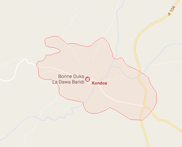
Kondoa Town is located in the North of Dodoma region for a distance of 160 km from the capital town, Dodoma. The Council was established with effect from 2015 vide a certificate of establishment under the terms of the provisions of sections 8 & 9 of the Local Government ( Town Authorities) Act 8, 1982. The Town lies between latitude 40 12” to 5º 38, 5” south, and longitude 350 6” to 360 2” east. Much of the Town is plateau rising gradually from 900m above sea level to 2,190m above sea level. In the North, the Town borders with Kondoa District Council and Chemba District in the South.

Area and Administrative units

The  Town has an area of 916.53 sq. km. Administrative units of Kondoa  Town contains of  2 (with two wards)  divisions, 8 wards, 25 villages and 11 mitaa. From 1st July 2000 there is establishment of Kondoa Township which known, as Kondoa Township Authority this authority shall have a freedom of deciding and implements all development activities. Kondoa Township authority had 8 wards, 16 villages and 11 mitaa in 2 divisions. From 1st July 2015 was established as Kondoa  Town Council. It has 8 wards,  25 villages and 11 mitaa in 2 divisions namely Kondoa Mjini and Kolo with 2 wards of Bolisa and Kolo as follows:

Table 1: Administrative Units of Kondoa Township

Division
No. of wards
No. of villages
No. of Mitaa
Kondoa Mjini
6
19
11
Kolo
2
6
-

Source: KTHRO, 2016

Therefore Kondoa Town shall have 8 wards (Kolo appears in both), 25 villages and 11 Mitaa.

Table 2: Administrative Units of Kondoa Town

Division
No. Of wards
No. of villages/Mitaa
2.  Kolo
2
6
4.  Kondoa Mjini
6
30
 
8
36

Source: KTPLO, 2016

1.3       Population distribution

According to the 2012 National Housing and Population Census, the Town has a population of 59,022 (Male: 29,177 Female: 29,845) with an average growth rate of 1.76% per annum. The average size of the household is 4.8 persons. The average Population density is 1:49 sq. km.

Table 3: Population Distribution by wards and sex

S/N
WARD NAME
TOTAL
MALE
FEMALE
HHS
1
Serya
6,054
3,188
2,866
4.8
2
Kilimani
7,237
3,503
3,734

3
Chemchem
7,914
3,797
4,117

4
Bolisa
3,644
1,812
1,832

5
Suruke
3,545
1,841
1,704

6
Kingale
11,003
5,602
5,401

7
Kondoa Mjini
14,382
6,744
7,638

8
Kolo
5,243
2,690
2,553


Total
59,022
29,177
29,845


    Source: 2012 TPHC


1.4       Ethnic Groups

Bantu speaking people who form about 80% of the Town population mainly inhabit the Town. This is Warangi. The ethnic group has same characteristic with differences in economic activities; some countryside community depend on animal husbandry while others primarily depend on agriculture and some in business. Areas of similar agro-ecological characteristics often exploit similar options for survival. The group have similar development level and face similar problems in development, with some small variations.

1.5       Climate

Climatically, Kondoa Town is part of the semi arid area of the central plateau of Tanzania (average altitude of 1,200 m) with an average rainfall of between 500-1000 mm. About 85% of the annual rainfall, falls between December and March with a dry spell in February. The rainfall patterns in the Town are unevenly distributed. The mean Town average temperature ranges between 16o -26oC. Mean annual relative humidity is 67% with more or less annual sunshine of 7 hour per day.

1.6       Vegetation

The Town has bush land with isolated bush grasslands. In the dry season the bush land are usually devoid of grass. The total area of the forest in the Town is 251, 379.1 ha. Central Government forest has an area of 49,046.7 ha while the Town council forest has an area of 4,249 ha. Natural forest has an area of 2,200 ha. The area for primary schools and other institutions is 494 ha. HADO area has an area of 125,600 ha. of forest. About 70% of the total area of the Town has potential for agriculture. Main crops grown are maize, finger millet, millet and sunflowers.

1.7       Agro-Ecological zones

The characteristics of the Kondoa Town landscape consist of extensive undulating plateau and plains, arid to semi-arid in the East and Southeast and slightly more humid in the Northwest and west. Extensive complexes of rocky hills, steep escarpments, interrupt these and large seasonal flooded depressions. The main agro-ecological zones are as follows:

Table 4: Main Agro-Ecological Zones (refer to map on following page)

Agro-Ecological Zone (Code)
Altitude (m.a.s.l.)
Average Annual Rainfall (mm)
Parent Rock
Coverage/Location
Cultivation
A1
900-1050
500-600
(Unconsolidated colluvia materials derived from granitic rocks
Bubu river
Few subsistence crops no cash crops.
C1
1300-1550
600-700
Unconsolidated alluvial/colluvia materials derived from granitic rocks and undifferentiated basement complex rocks,mainly gneiss's
Kolo Division
Maize, sorghum, millet simsim, sunflower and beans
C2
1300-1550
600-700
Unconsolidated alluvial/colluvia materials derived from granitic rocks and undifferentiated basement complex rocks,mainly gneiss's
Along sand rivers in highlands
Maize, sorghum and maize
C3
1300-1550
500-600
Unconsolidated alluvial/colluvia materials derived from granitic rocks and undifferentiated basement complex rocks,mainly gneiss's
Bubu river in Kolo divisions
Maize, sorghum and maize
D1
1550-1880
700-800
Granitic rocks
Irangi highlands within river plains
Maize, and Millet
D2
1550-1800
600-900
Granitic rocks
Bubu river utmost of Kondoa  Town.
Millet, Pigeon peas and beans

Source:  KIRDEP 1997

CHAPTER TWO


THE TOWN ECONOMY


2.1 The basic land use 

The fundamental land use plan for the Town economy depends on the following dimensions namely as;

Agricultural land

Land use for pasture

Natural forest reserves

Game reserve

Open land

2.2       Crop production

The Town is almost entirely dependent on agriculture and animal husbandry, which are locally practised in rural areas at subsistence level. The average farm size varies from 5 acres (in intensified agricultural areas) to 10 acres in low lands. Household incomes are influenced by crop yields. The agriculture is characterised by low productivity resulting from low and erratic rainfall high, evade-transpiration and low moisture holding surface soils. These conditions, compounded by poor farming practices and widespread overstocking/overgrazing, make the Town susceptible to extensive soil erosion. The main crops grown in the Town include sorghum, bulrush millet and maize; major cash crops are maize, groundnuts, sunflower, castor seeds, sesame etc. Only about 20% of the farm produce is offered for the market. The total arable land of the Town is 20,127 ha. The land under cultivation is estimated at 19,127 ha. (This is about 24% of the total arable land).        

Table 5: Crop production for the past three seasons compared to area cultivated

Season
2015/16
2016/17
Crops
Area (Ha)
Tons
Area (Ha)
Tons
Sorghum
1849.75
2404.675
2642.5
3435
Pear millet
2592.45
3240.5625
3703.3
4629
Maize
4167.1
6667.36
5953
9525
Sunflower
2875.6
2300.48
4108
3286
Finger millet
1,232
1848
821.5
1232
Sesame
119.7
71.82
171
103
Beans
215.95
172.76
308.5
231
Pigeon Peas
183.75
147
262.5
210
Groundnuts
183.75
91.875
262.5
197
Cassava
504.35
3530.5
720.5
5044
Cow peas
230
184
247
198
Source: TAICO 2016

2.3 Livestock

Livestock ranks as the second contributor to the Town economy providing a substantial source of income for the cattle owners. According to 2016 estimates the Town has a total of 102,296 livestock comprising 19,800 cattle, 18,216 goats, 3,356 sheep, 686 pigs,poultry 58,974 and 1,264 donkeys.  The livestock density per area suitable for grazing is 22.4 LU per Km2.

Cattle keeping are small scale, with the majority of livestock being owned by the pastoralists in the Town. Zero grazing of cows and especially dairy goats and improved poultry is developing, but there is potential only in certain Agro-Ecological Zones. A Paravet scheme was initiated in 1998 and is developing well.

Table 6: Number of Livestock per ward

NA.

NUMBER OF LIVESTOCK
CATTLE
GOATS
SHEEP
PIGS
HENS
DONKEYS
1
Serya
3457
2925
534
-
6719
112
2
Kilimani
971
1138
142
120
6488
106
3
Chemchem
879
678
102
354
9971
54
4
Bolisa
2745
2342
145
-
6978
98
5
Kingale
5525
5353
1197
-
6996
322
6
Kondoa Mjini
988
756
97
212
7754
45
7
Kolo
1879
2150
427
-
6989
109
8
Suruke
3356
2874
712
-
7079
418
TOTAL
 
19800
18216
3356
686
58974
1264
   Source:  TLFO, 2016

Table 7: Livestock services and infrastructure

NO.
TYPE OF SERVICE/ INFRASTRUCTURE
NUMBER
TOTAL
FUNCTIONING

Matangazo

  • Tangazo la kuitwa kwenye usaili nafasi ya Katibu Muhtasi na Madereva Halmashauri ya Mji Kondoa February 24, 2023
  • Matokeo ya Kidato cha nne Shule za Halmashauri ya Mji Kondoa January 29, 2023
  • Waliochaguliwa na shule walizopangiwa kidato cha kwanza 2023 Kondoa Mji December 14, 2022
  • Tangazo la kazi December 07, 2022
  • Tazama Vyote

Habari Mpya

  • Mhe. Rais, Ditopile watoa milioni 15 kwa Wanawake wa Vikoba Kondoa

    March 13, 2023
  • "Shirikianeni watoro warudi shuleni"- Mkurugenzi Sweya

    March 09, 2023
  • RC Senyamule aongoza Wanawake wa Dodoma kuadhimisha siku yao Duniani

    March 08, 2023
  • Madaktari bingwa wawashauri wananchi kuchunguza afya mapema

    March 05, 2023
  • Tazama Vyote

Video

Fursa za uwekezaji Kondoa Mji
Video Zaidi

Kurasa za Karibu

  • Mpango Mkakati
  • Maktaba ya Picha
  • Orodha ya Waheshimiwa Madiwani
  • Sheria ndogo
  • Ripoti Mbalimbali
  • Fomu Mbalimbali
  • Miradi Inayoendelea

Tovuti Linganifu

  • Ikulu
  • Utumishi
  • TAMISEMI
  • Idara Kuu ya Takwimu (NBS)
  • Idara ya Habari Maelezo
  • Tovuti Kuu ya Serikali

World visitors tracker

world map hits counter

Waliotembelea Tovuti

free HitCounter

Ramani ya Mahali

Wasiliana nasi

    Mtaa wa Kwapakacha

    Anuani ya Posta: S.L.P 711

    Simu ya Mezani: +255 712264912

    Simu ya Mkononi: +255 712264912

    Barua Pepe: td@kondoatc.go.tz

Mawasiliano Mengine


    • Sera ya Faraga
    • Kanusho
    • Ramani

Haki Miliki ©2017 Halmashauri ya Mji Kondoa - Haki Zote Zimehifadhiwa